We had a great breakfast at the Goodland KOA and got to talk
with the owners – Polish immigrants who spent 22 years in Chicago before buying the campground. We also
discovered that one of our camping neighbors was someone that we camped with in
the Keys. They shipped their very unique camper over from Switzerland . It is adorned with many scenes depicting the
National Parks of the US .
We didn’t get to speak with them since we made an early departure. I have seen
some small abandoned houses along the way, thinking at least some of them might
have been homesteads. There is a Flagler, CO.
He’s everywhere, and yes, it’s on the railroad.
A big sign advertises “FREE LAND - we’ve got land, we’ve got
water, all we need is YOU!” Not me, though. Last night we camped at about 3000 feet
altitude, today at 9:40 AM mountain time we hit a mile high, 5280 feet. Gasp!
We rather abruptly left the plains at Colorado Springs . We got on Rt 115 to Rt. 50. We’ve been following the Arkansas
River through its gorge. The road is rather twisty, in many places
rocks rising straight up from the road and on the other side of the river
also. We share the gorge with the
railroad. When the gorge is properly
aligned we can see snowy peaks in the distance.
We will cross the Continental Divide this afternoon. Now we’re in Salida , CO
Yup. We crossed the
Continental Divide at Monarch
Pass Syracuse ,
NY Hyde Park at the Culinary and plan to go back in a few
weeks to take a cooking class! Small
world – you can’t get away with anything.
We crossed another pass west of the divide, the road there was steeper with many 30 and 35
mph curves on the down (west) side, but very scenic. We got an electric site in the Black Canyon
National Park
Saw this RV in the Keys
Royal Gorge
Climbing to the pass, Rockies in the distance
Taken by people from Syracuse
We've been to all 48!
Camped at 8350 feet
Today we toured Black
Canyon of the Gunnison National Park Gunnison River
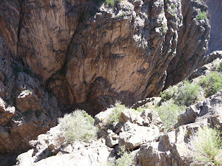
Gunnison River 2000 feet down
more down
Mom's getting pretty near the edge
Painted Wall


Very brave, getting so close to the edge!
ReplyDelete