Friday August 2
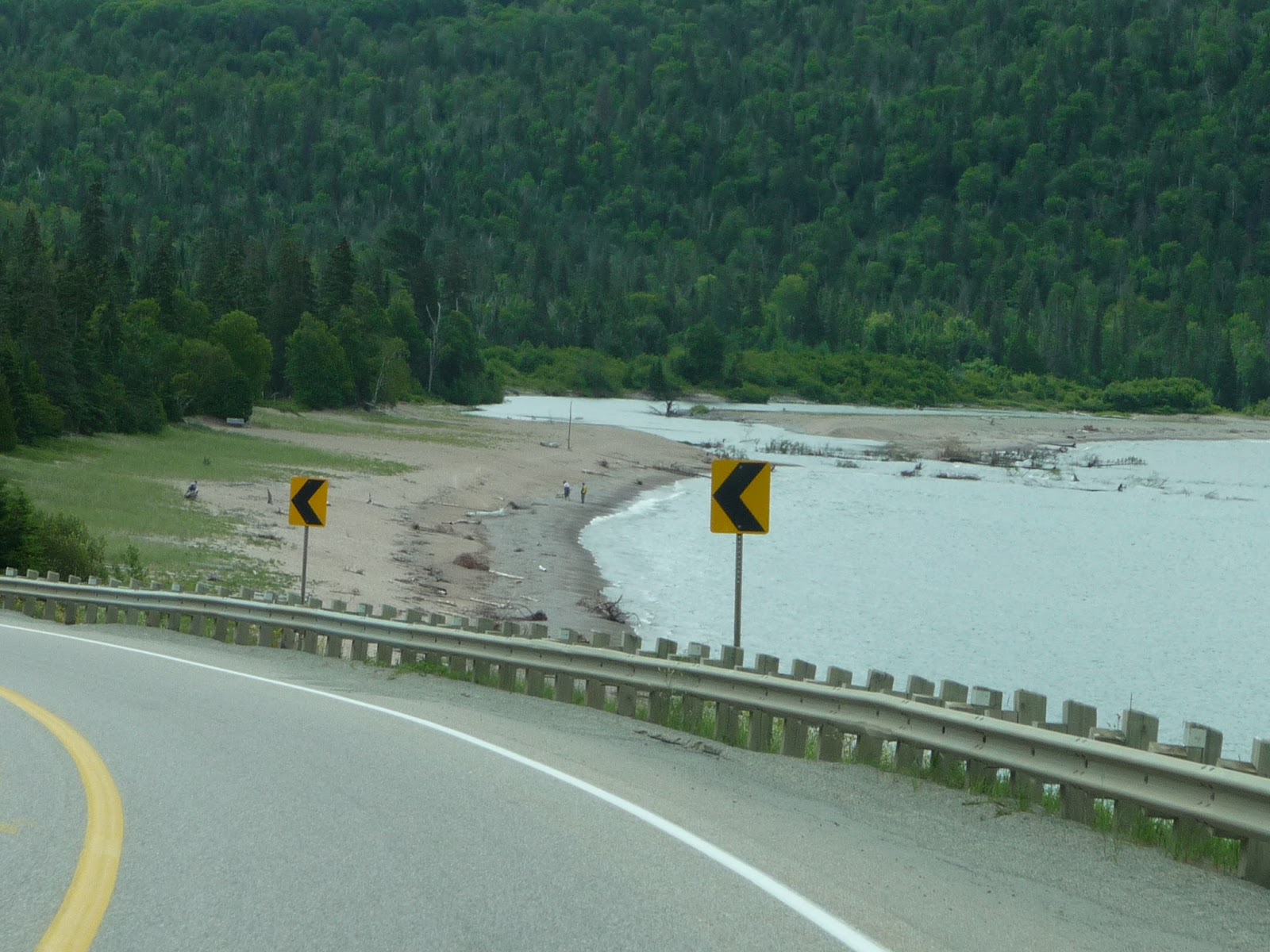
Travelling up Route 61 we were parallel to and often very
close to the shore
of Lake Superior,
catching glimpses of the lake from time to time. Part of the trip is mostly flat
wilderness. This gave way to hillier
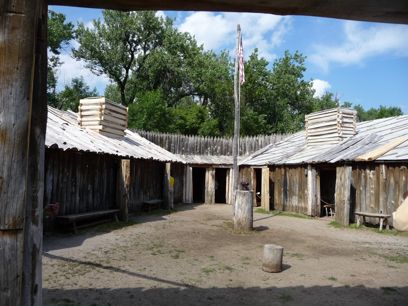
terrain and, in the middle of nowhere, a spa and resort. Apparently there is skiing nearby. Shortly before the border is the Grand Portage
National Monument, close
to the town of …..Portage on …..Grand Portage Bay,
Lake Superior.
Of course we stopped. The
monument marks the spot where the Grand Portage – an 8 ½ mile long trail to the
Pigeon River – began. This is the route people have used for
thousands of years to connect the interior of Canada to the lake. The Pigeon
River connects to the many lakes in
interior Canada. The British North West Company established a
summer fort and trading post at the site, and the National Park Service in
conjunction with the Ojibwe Indians has also constructed a summer Indian
village at the site. Voyageurs and
Indians would traverse the portage to bring their pelts and other goods to the
fort to trade for manufactured goods.
Shortly after the monument we cleared customs and were in
Canada! The first hour or so we travelled through
fields of corn and other crops. This
relatively flat land gave way to rocky hills and pine forest. We’ve gotten used to finding a town every 30
miles or so, and this didn’t change except that the towns were 45 kilometers
apart and we’re in the Eastern time zone (at the Canadian border). Eventually we arrived at
Neys Provincial
Park, our camping spot
for the evening. I had reserved a spot
online, back in, 50 feet long. What the
computer and the person that checked us in didn’t tell us was that the site was
down a winding logging road through the forest (ideal for a tent!). We wound our way along a muddy track with
branches brushing both sides of the camper.
We missed the main parts of the trees, anyway. When we found the site there was no way I
could get in, so we continued around the “loop” back to the booth. They had another site available in another
loop, but I couldn’t get into that either.
By this time Mom was convinced we were going to get trapped in THE DEEP
VOODS, so I got a refund. Across the
main road was a general store/campground that wasn’t in Woodall’s directory,
but it looked good to us. We’re in their
overflow area (a field) with 15 amp electricity (fine with me) camped next to a
couple from Mystic,
Connecticut. By the way, we were checked in to this camp
by a friend of the owner – the owner was out baiting bears. The Neys Lunch and Campground is also a Black
Bear outfitter.
Lake Superior north shore in Minnesota
AAAHHHHH!
Indian summer camp at Grand Portage NM
Grand Portage trading post
The road we entered Minnesota on was too small to have a sign
Cool rocks
The Lake again
Lots of forest, not many towns or houses or anything
The road in Neys Provincial Park campground. This part is good, Mom spent most of the experience with her head out the window watching for branches and trees.
Saturday August 3
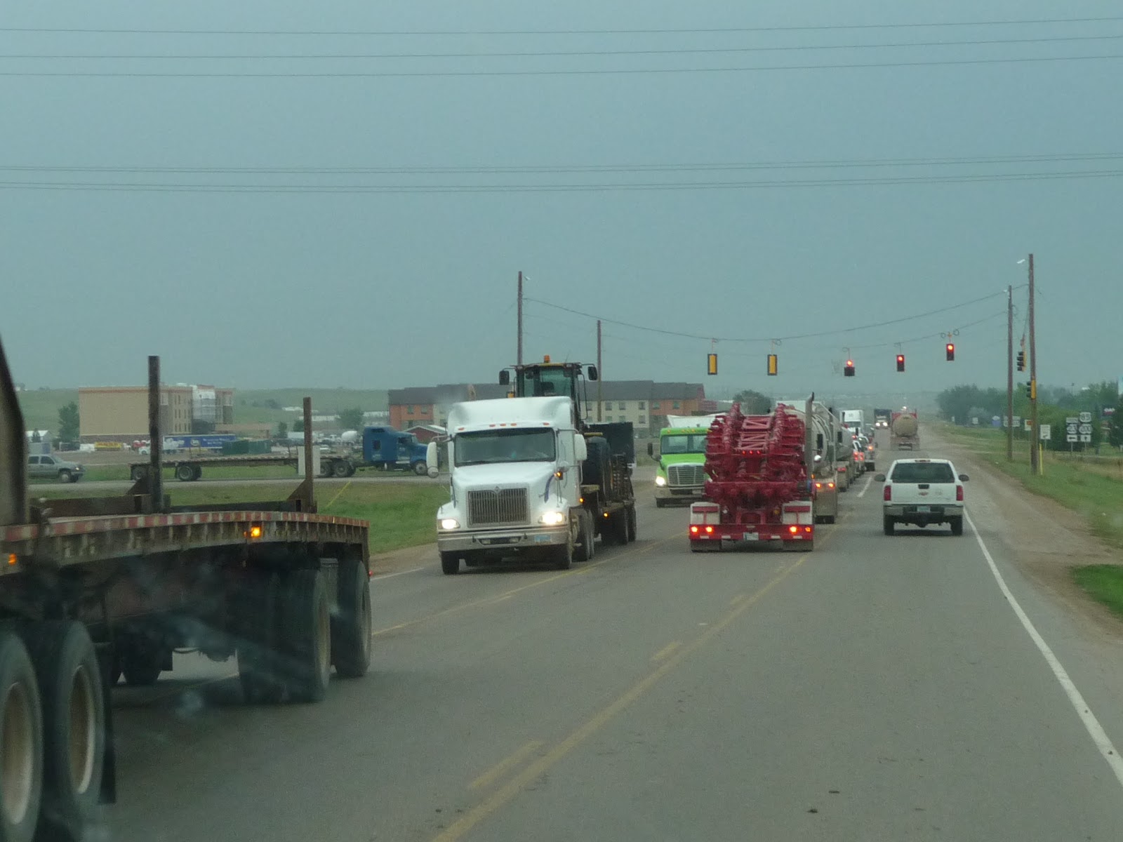
The trip from Neys to Sault Ste. Marie was a get from here
to there drive. Sometimes we were on the
shore of Lake Superior, sometimes inland, a lot
of up and down over pine tree covered rocky hills. One of the rock cuts was fascinating – the
“rock” had smooth river rock boulders included in it. The only interesting stop was an Ojibwe
Indian trading post/tourist stop. There
were some genuine handmade items among the commercial items. Crossing into the U.S. took about an hour in traffic,
but our individual interview was quick and easy. No camper search, no probing questions. The crossing at Vancouver was more difficult.
Once in Sault Ste. Marie we found our campground, right on
the St. Mary river below the Soo locks.
All of the Lake freighter traffic
passes right by the campground, less
than 100 yards off shore. The boats
themselves are up to 1000 feet long, so they look really big when they are that
close. We went to the locks to watch
ships lock through. We saw two that were
about 750 feet long, later in the evening a 1000 footer passed the campground
after dark. The city itself has a nice
tourist area along the St. Mary river and locks. We ate at a seafood place by the lock and
watched a ship being raised during dinner.
Definitely a water oriented city.

At Neys Lunch, Campground, and Bear Outfitters
Lake Superior
Eastern shore of Lake Superior
Lake Superior
Bridge from Sault Ste. Marie, Ontario, Canada to Sault Ste. Marie, Michigan, USA. Don't let the speed sign fool you, we stopped dead in another 100 yards (oops, still in Canada - 90 meters)
St. Mary River rapids in foreground, Soo Locks in background
Sault Ste. Marie, Michigan, USA
Lake Freighter coming past our campsite on the St. Mary River
Me and bow of the boat by the camper.
Freighter leaving the Soo Locks
Another freighter appearing in another one of the locks
Sault Ste. Marie wisdom
View of the St. Mary River through the camper window